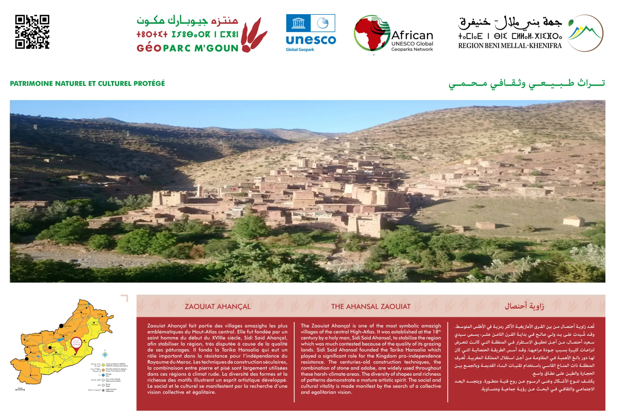
Zaouiat Ahançal
Cultural and natural heritage of the High Atlas
Overview
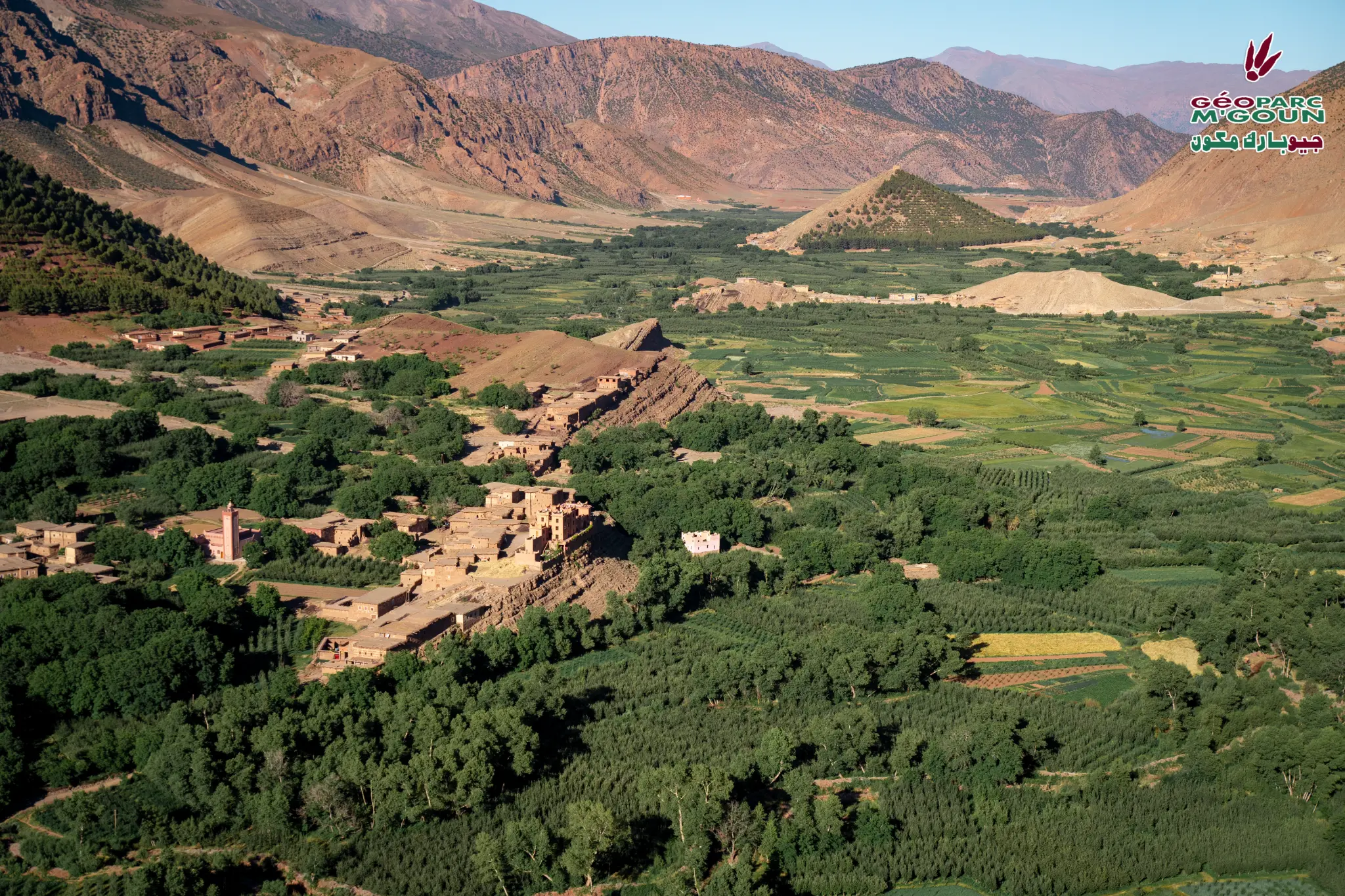
Zaouiat Ahançal is one of the most emblematic Amazigh villages in the central High Atlas. It was founded at the beginning of the 18th century by a holy man, Sidi Said Ahançal, in order to stabilize the highly disputed region because of the quality of its mountain pastures. This holy man founded the Tarika Hansalia which had an important role in the organization of the resistance for the independence of the Kingdom of Morocco.
Centuries-old construction techniques, the combination of stone and pisé, are widely used in these regions with a harsh climate (snow, rain, cold). The diversity of forms and the richness of patterns illustrate a developed artistic spirit. The social and cultural are manifested by the search for a collective and egalitarian vision. Zawiat Ahançal is a unique land with a variety of tribal rights, pastoral lands and stunning natural beauty.
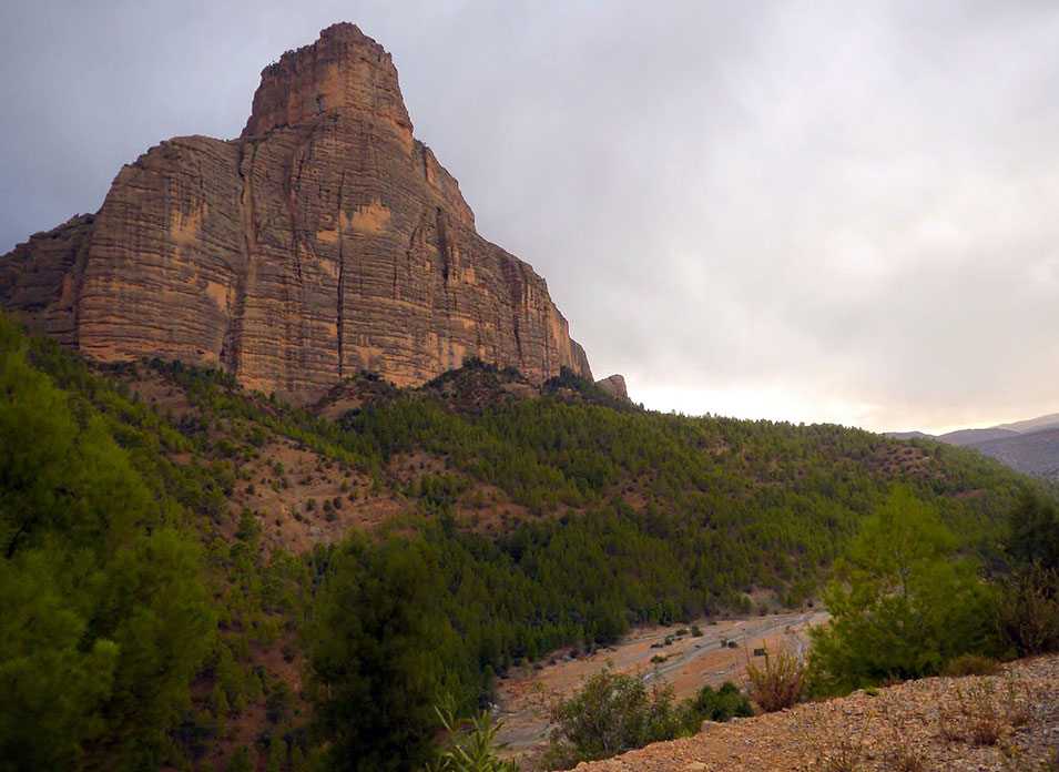
The geological panorama of Zaouiat Ahançal presents three successive formations: the Amezrau formation (sandstone-limestone with large Megalodons and red clays, Carixian-Domerian, −185 Ma), the Aguerd-n-Tazoult formation (marl/sandstone/limestone with desiccation cracks, Toarcian-Aalenian, −180 Ma), and the Ait Abdi formation (thick Aalenian-Bajocian oolitic limestone, −170 Ma) showing tectonic structures with faults and folds, reflecting the Atlas compression phases.
Access & Distances
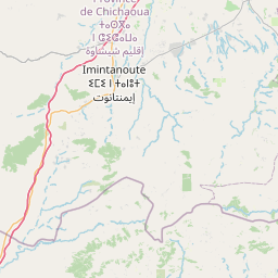
GPS Coordinates
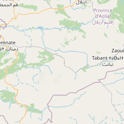
31.6833° N, 6.5500° W — Zaouiat Ahançal
Via Bin El Ouidane and Azilal from Beni Mellal. Track to Taghia (11 km from Agoudim).
Attractions & Points of Interest
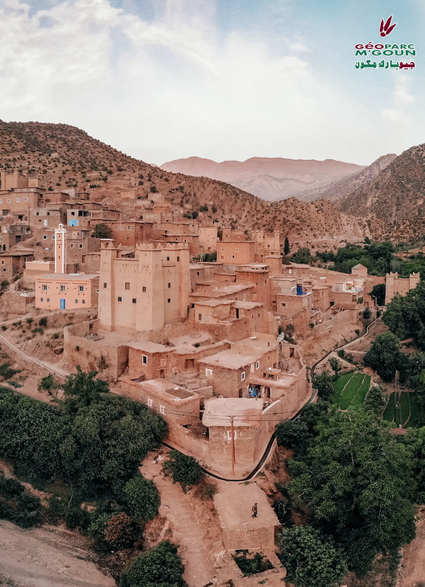
Kasbah of Agoudim
Emblematic earthen fortress dominating the valley, witness to the history and Berber defensive architecture of the Central High Atlas.
Collective Granaries of Amezray
Fortified collective granaries (agadirs) of Amezray village, symbols of Amazigh solidarity and social organization.
Taghia Cirque
Rocky cirque with 1000 m vertical walls, world paradise for climbing with world-class routes on limestone.
Berber Passage
Ancestral passage connecting the High Atlas valleys, used for centuries by caravans and transhumant nomads.
Watermills of Agoudim
Traditional watermills fed by the Assif-n-ou-Ahançal river, witnesses to the hydraulic genius of Amazigh communities.
Ramsar Site Assif-n-ou-Ahançal
Wetland of international importance classified as Ramsar, with constant year-round flow fed by abundant precipitation.
High Altitude Sheepfolds
Traditional sheepfolds on high-altitude plateaus where the Ait Abdi and Ait Atta tribes practice transhumant herding.
Collective Pastures
Vast collective pastures managed according to ancestral Amazigh customary rules, ensuring sustainable resource management.
Activities
Photo Gallery
Official interpretive panel — Zaouiat Ahansal
Built Heritage
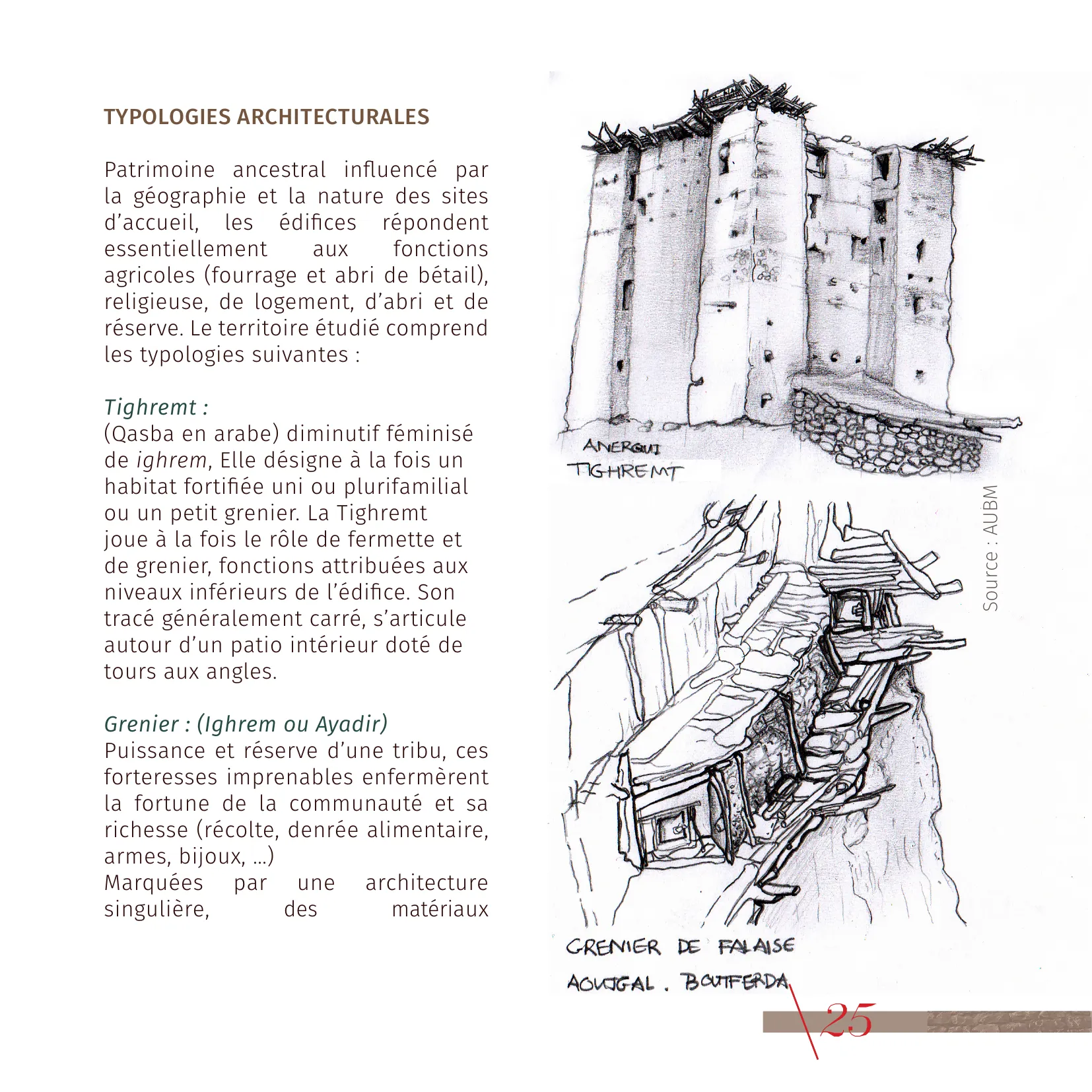
Cliff Granaries & Amazigh Architecture
Zaouiat Ahansal is home to one of the most spectacular examples of Amazigh architecture in the High Atlas: the Aoujgal cliff granaries. Built in the middle of an almost inaccessible cliff, overlooking the Attach wadi, on a marly ledge between two massive limestone bars of the Ait Abdi formation (−170 Ma), they are built along a 400-metre axis, accessible via a wooden and stone staircase 700 metres long.
These collective granaries (Ighrem or Ayadir) were the community's impregnable fortresses, holding tribal wealth: harvest, foodstuffs, weapons, jewellery. An exceptional and unique site steeped in history, testifying to the way of life of the local Amazigh populations and their constructive genius adapted to the natural environment.
Tomb of Sidi Said Ahansal
The territory of Zaouiat Ahansal is also marked by its religious buildings: mausoleums, zaouias and mosques dot the territory along the path of the saints. The tomb of Sidi Said Ahansal, founder of the zaouia, is a place of pilgrimage and community rites essential to the social life of Amazigh villages.
Anergui Tighremt & Aoujgal Granary © AUBM
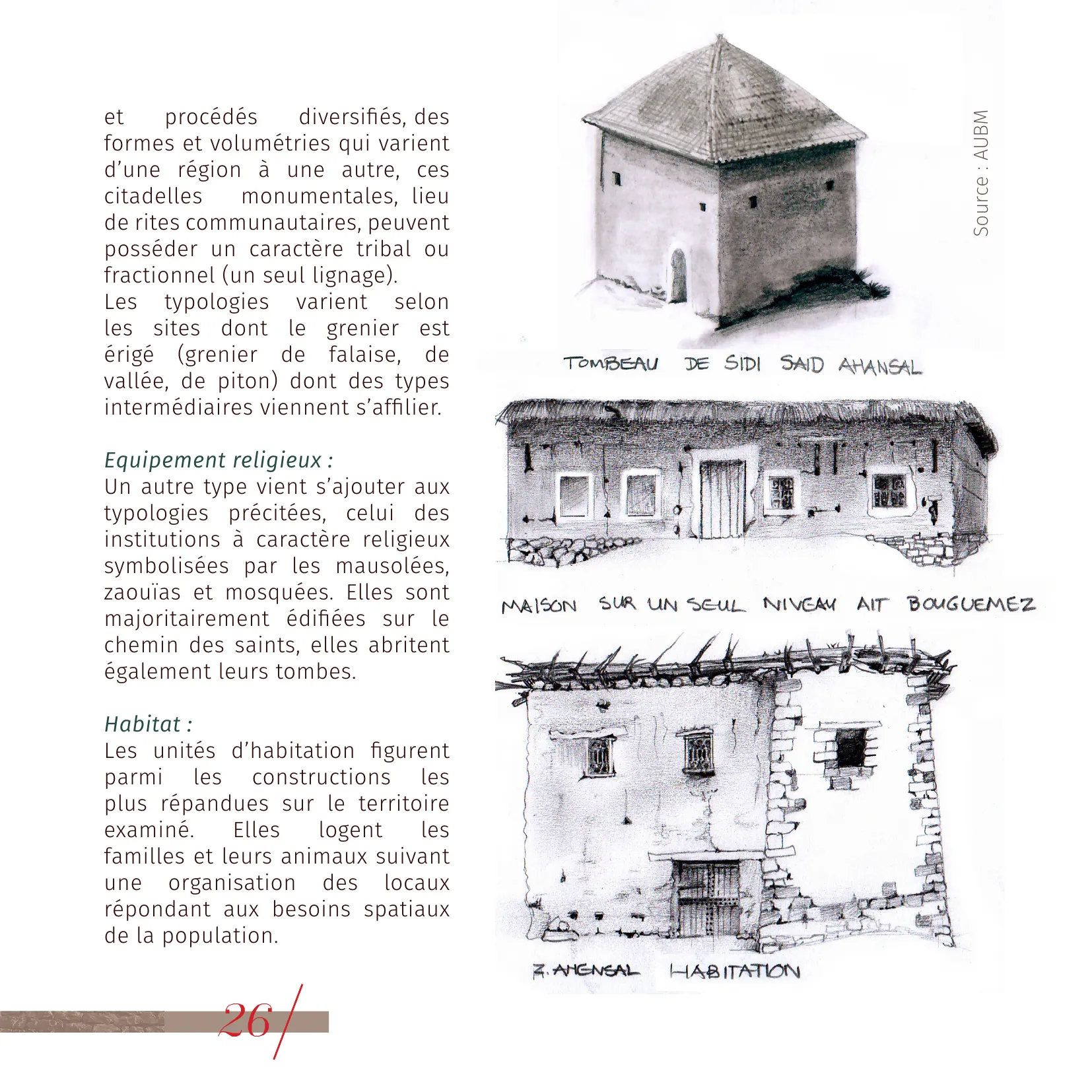
Sidi Said Ahansal Tomb & Aït Bougumez House © AUBM
Source: Architectural Charter of the Central High Atlas, AUBM.
Official Tourist Guide
Download the official tourist guide of Zaouiat Ahansal to prepare your visit.
Download Guide (PDF)Location & Access
Zaouiat Ahansal is accessible from Marrakech (250 km) via Azilal and Tilouguit.