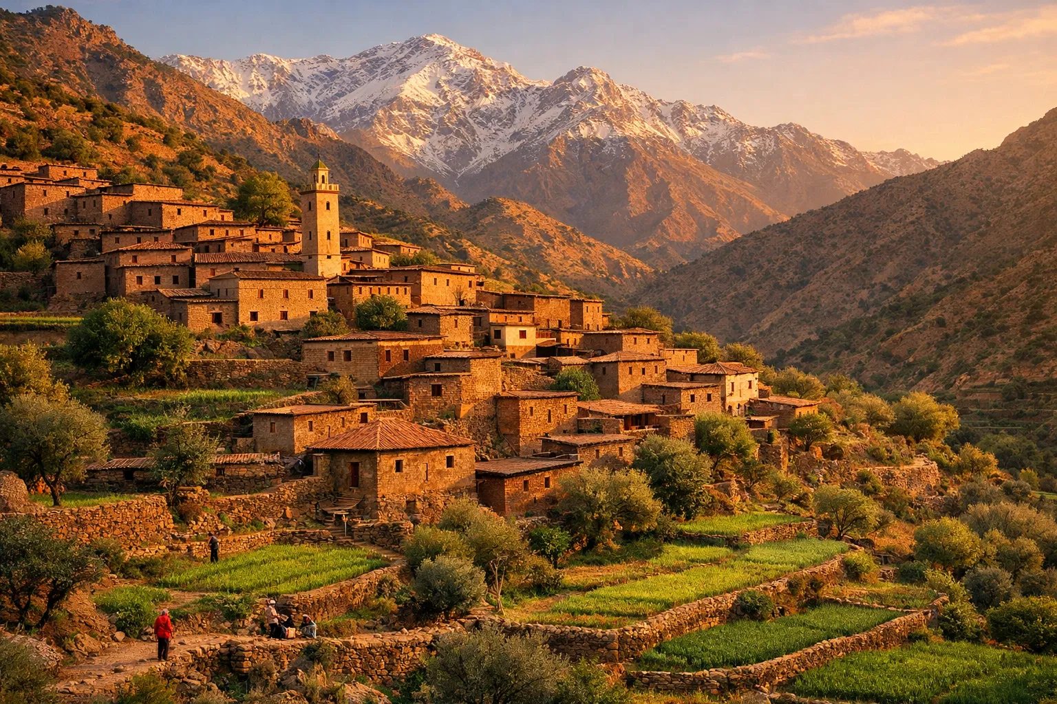
M'Goun Geopark Maps
Official maps of M'Goun Geopark: geotouristic map, geological map, geosite locations and territorial boundaries.
Map Collection
Official maps established by SOUHEL Abdelatif & BOUTAKIOUT Mohamed, 2023 edition.
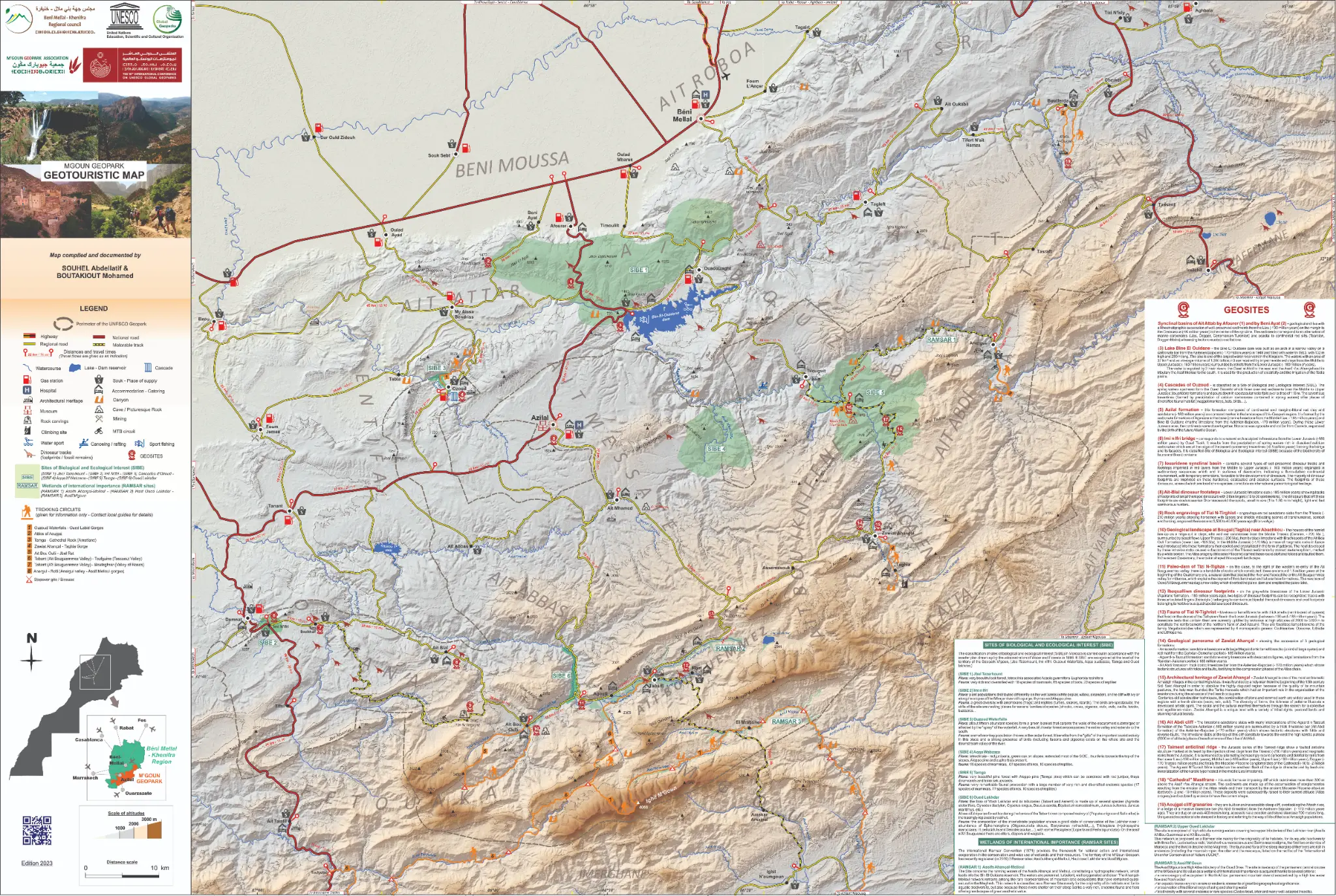
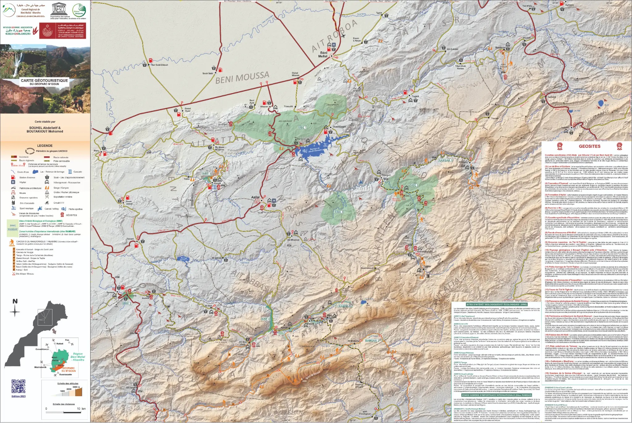

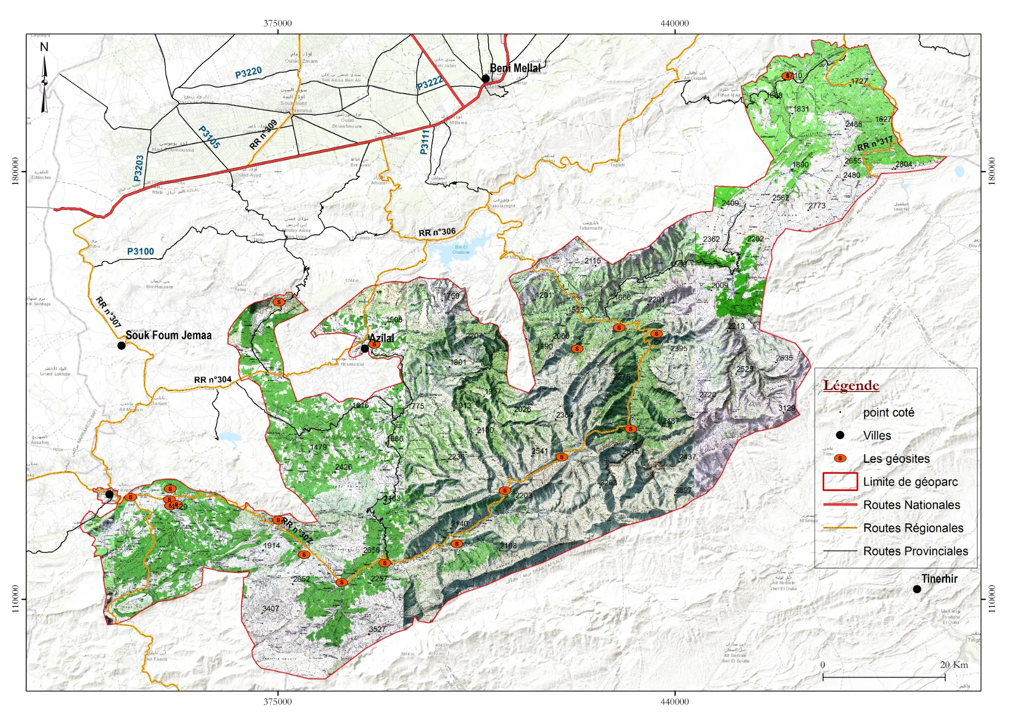
Geotouristic Map (English)
2023 Edition • SOUHEL Abdelatif & BOUTAKIOUT Mohamed
Understanding the Maps
Geotouristic Maps
Present tourist circuits, accessible geosites, visitor centers and reception infrastructure. Available in French and English.
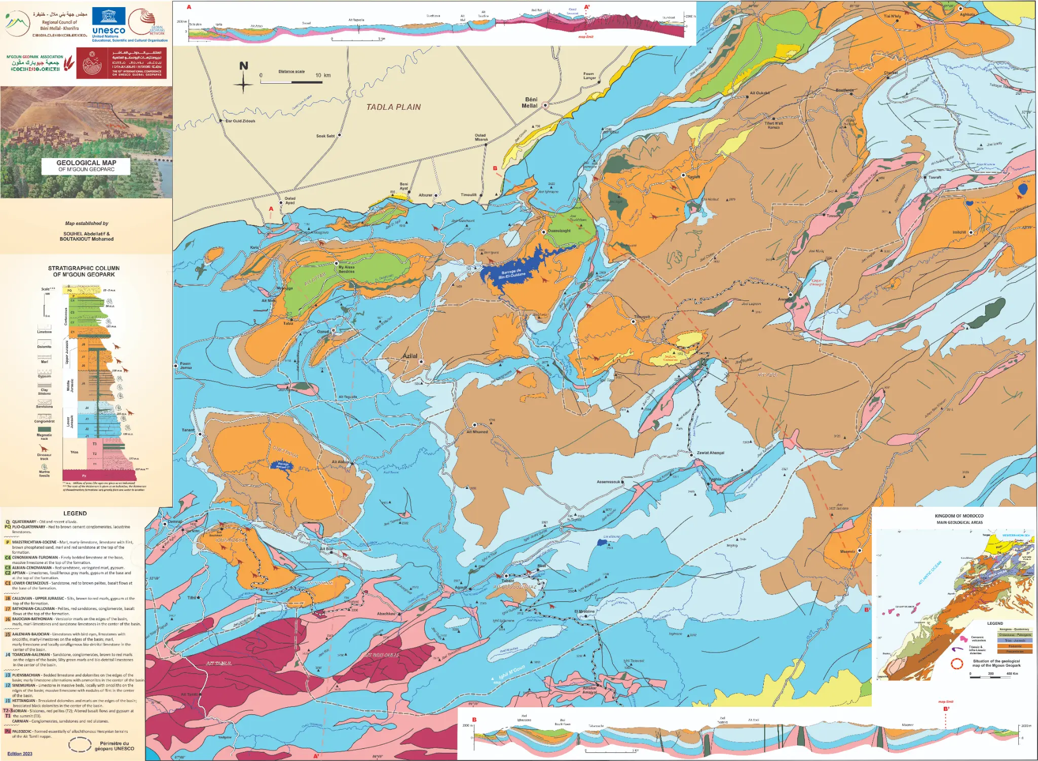
Geological Maps
Illustrate geological formations, geological eras, faults and tectonic structures of the geopark territory.
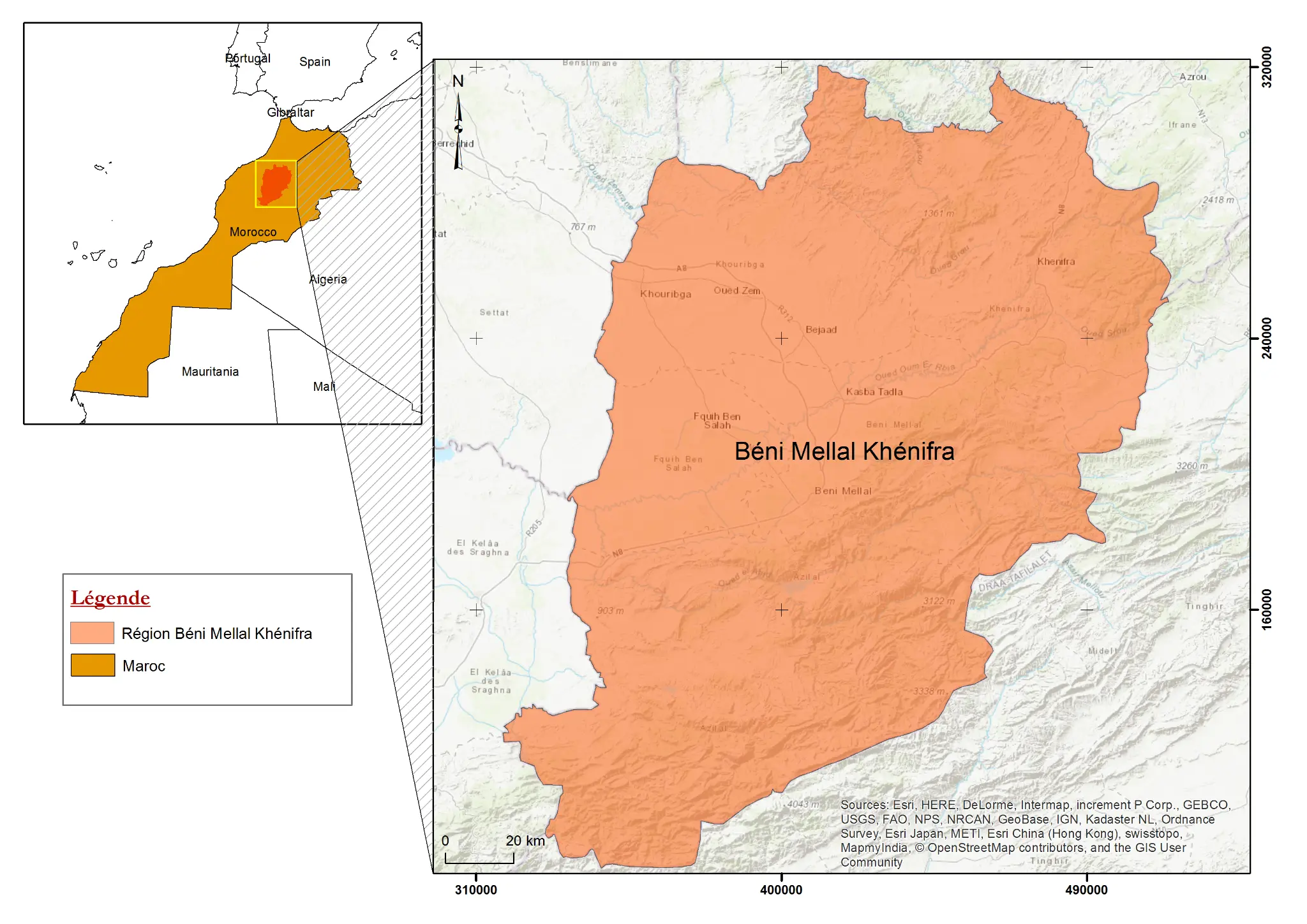
Location Maps
Situate the geopark in its regional and national context, with major cities, roads and access points.
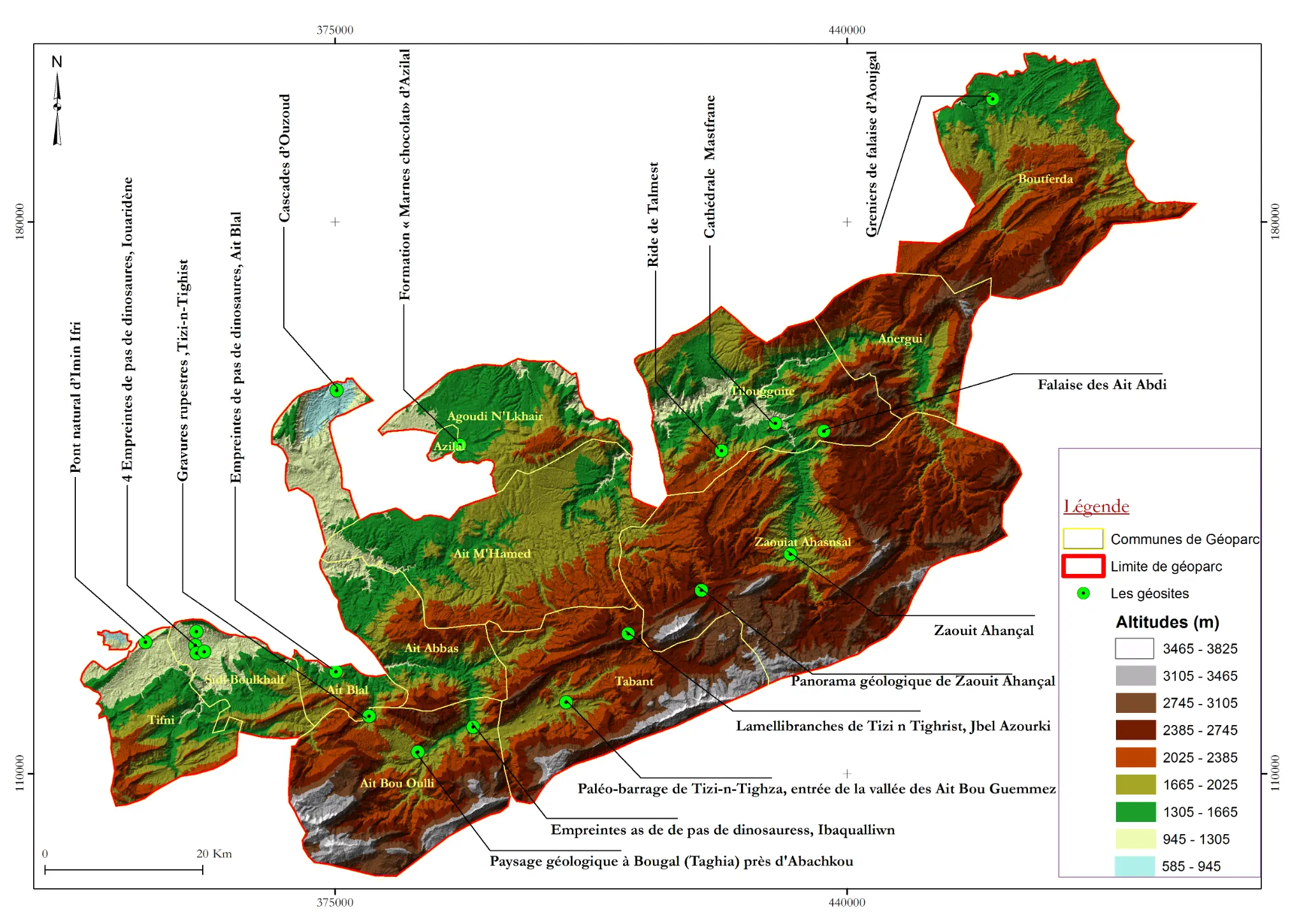
Geosite Maps
Precisely locate the 22 geosites of the geopark with their GPS coordinates and accessibility level.
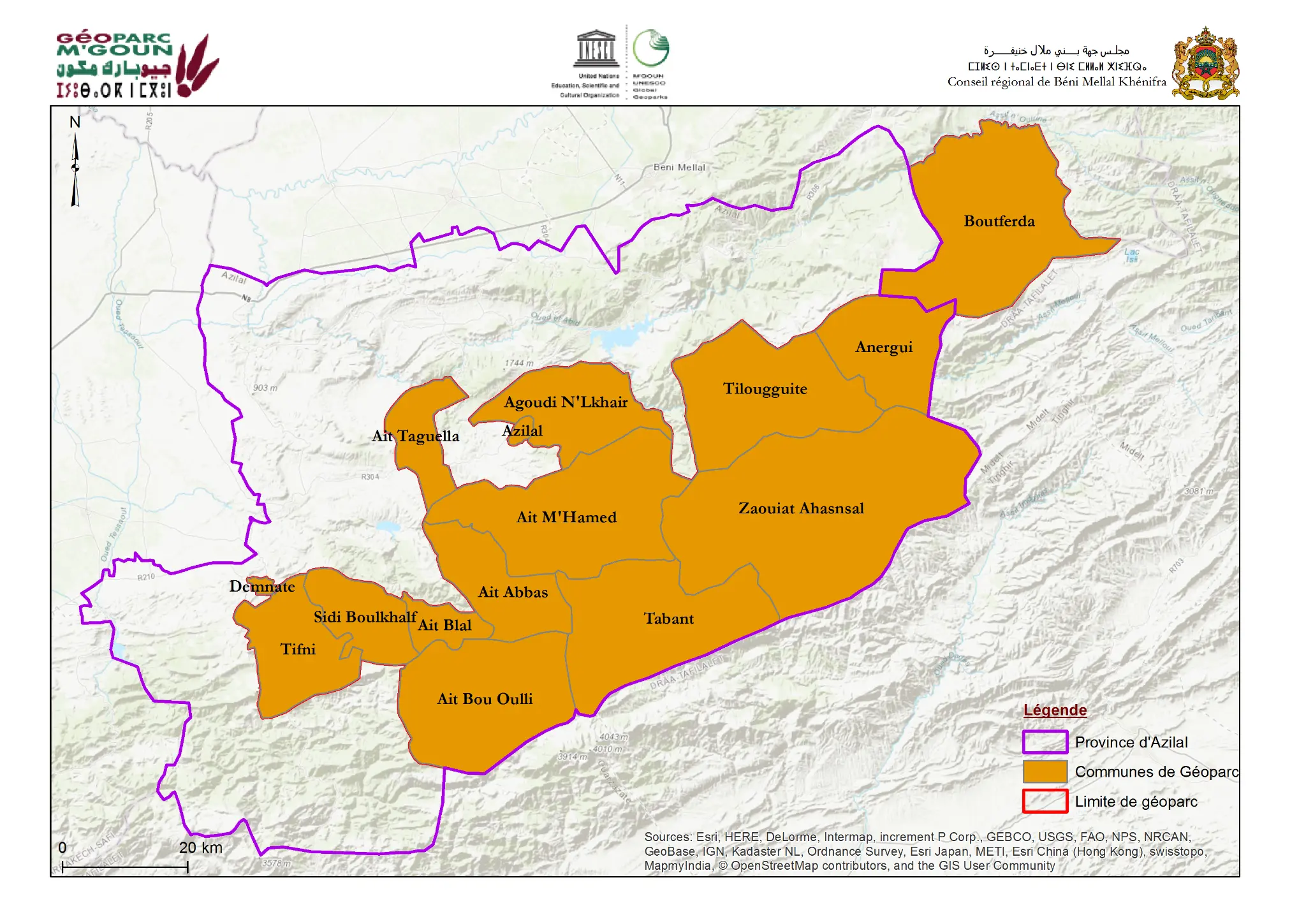
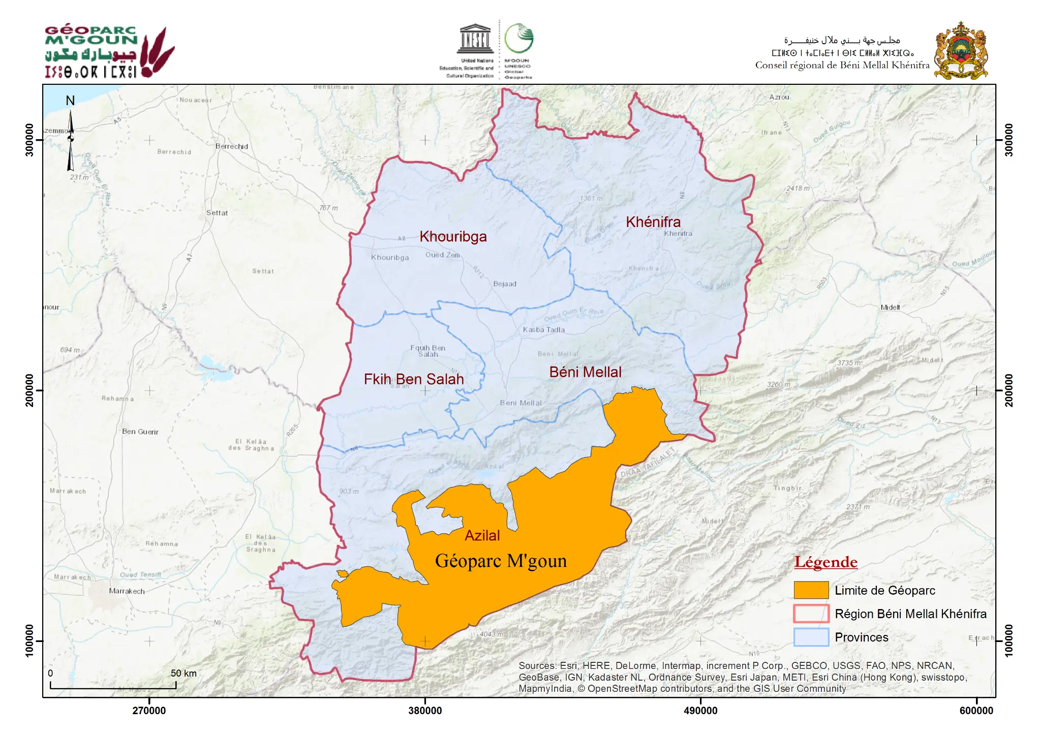
Boundary Maps
Define the administrative boundaries of the geopark at provincial and regional level, including the 15 territorial municipalities.
Route Maps
Present the main tourist routes, hiking trails and recommended itineraries to discover the geopark.