National Geoparks
Moroccan National Commission for Education, Sciences and Culture & Geopark Projects
The Moroccan National Commission for UNESCO
The Moroccan National Commission for Education, Sciences and Culture (NATCOM Morocco) is the official body representing Morocco at UNESCO. It coordinates the implementation of UNESCO programs and activities at the national level and liaises between Moroccan institutions and UNESCO international bodies.
In the field of geoparks, NATCOM Morocco plays a crucial role in supporting Moroccan geopark projects in their UNESCO designation process. It supports project holders, facilitates contacts with international experts and represents Morocco at meetings of the UNESCO Global Geoparks International Council.
Morocco is today one of the most active countries in geopark development, with one active UNESCO geopark (M'Goun), one candidacy in progress (Chefchaouen) and no less than 9 projects under development across the national territory.
NATCOM Morocco Missions
National coordination
Coordinate UNESCO activities at the national level and ensure the link between Morocco and UNESCO international bodies.
Institutional support
Provide institutional support to Moroccan geopark projects in their UNESCO designation process.
Promotion of UNESCO values
Promote UNESCO values in education, sciences, culture and sustainable development in Morocco.
Supporting applications
Support Moroccan geopark project holders in preparing their UNESCO application files.
Kingdom of Morocco
UNESCO member since 1956. Pioneer of geoparks in Africa.
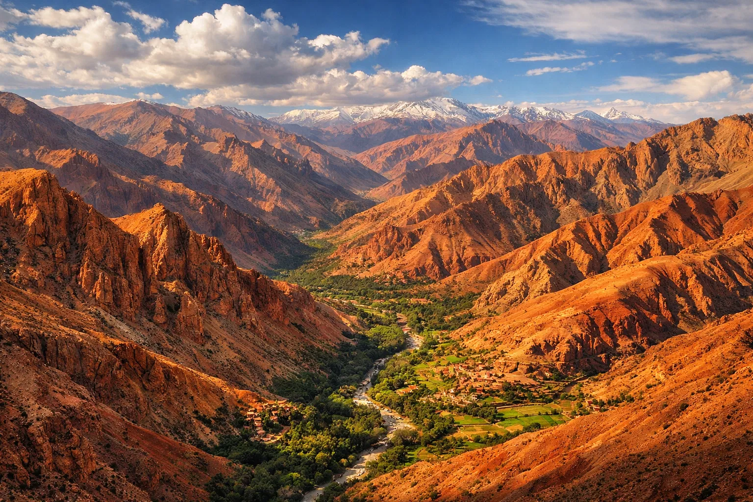
M'Goun: Moroccan model
M'Goun Geopark serves as a model for emerging Moroccan geopark projects, sharing its 10+ years of experience.
Discover M'GounList of Moroccan Geopark Projects
Morocco is actively developing its national geopark network, with projects in all regions of the Kingdom.
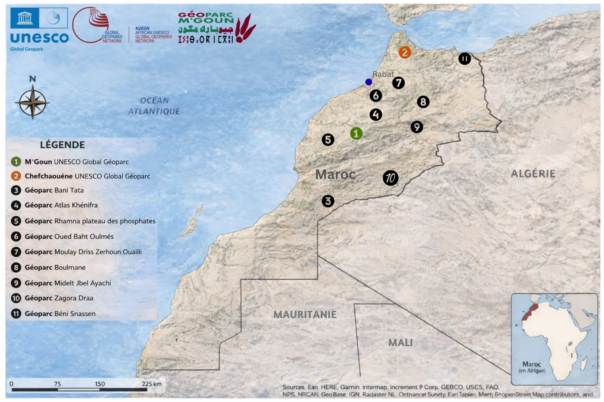
Location map of the 11 geopark projects in Morocco — Sources: Esri, HERE, Garmin, Intermap, GEBCO, USCS, FAO, NPS, NRCAN, GeoBase, IGN, Kadaster NL, Ordnance Survey, Esri Japan, METI, Esri China, OpenStreetMap contributors
Géoparc Mondial UNESCO du M'Goun
ActiveFirst UNESCO geopark in Africa and the Arab world (2014). 5,730 km², 22 labelled geosites, Central High Atlas.
Géoparc Chefchaouen
CandidateGeopark project in the Rif region, showcasing the geology and natural heritage of Chefchaouen.
Géoparc Bani Tata
ProjectGeopark project in the Anti-Atlas, a region rich in Precambrian geological formations and Saharan heritage.
Géoparc Moulay Driss Zerhoun – Oualili
ProjectProject combining the Volubilis archaeological site (UNESCO), Moulay Idriss springs and the geology of the Middle Atlas.
Géoparc Zagora Draa
ProjectGeopark project in the Draa Valley, showcasing Saharan landscapes, oases and the geological heritage of the desert.
Géoparc Rhamna – Plateau des Phosphates
ProjectProject showcasing the world's largest phosphate deposit, an exceptional geological and industrial heritage.
Géoparc Midelt – Jbel Ayachi
ProjectGeopark project around Jbel Ayachi (3,737 m), the highest peak of the Eastern High Atlas, rich in minerals and fossils.
Géoparc Boulmane
ProjectGeopark project in the Middle Atlas, showcasing karst landscapes, springs and Berber biodiversity.
Géoparc Béni Snassen
ProjectGeopark project in the Béni Snassen mountains, a limestone massif with caves, marine fossils and Mediterranean landscapes.
Géoparc Atlas Khénifra
ProjectGeopark project in the Khénifra region, heart of the Middle Atlas, showcasing springs, lakes and cedar forests.
Géoparc Oued Baht – Oulmès
ProjectGeopark project showcasing the Oulmès mineral waters, the geology of the central plateau and natural heritage.
Morocco's Vision for Geoparks
Morocco has developed an ambitious vision for the development of geoparks on its territory. Building on the success of M'Goun Geopark, the first African geopark, the Kingdom has committed to developing a national geopark network covering the main geological regions of the country.
This vision is part of the national strategy for sustainable development and promotion of natural and cultural heritage. Geoparks are seen as tools for integrated territorial development, combining conservation, education and local economic development.